Project Leader:ISHIKAWA, Masatoshi (Faculty of Business Administration, Tokyo Seitoku University)
Collaborators: UMEZAKI, Masahiro (Graduate School of Medicine, The University of Tokyo)
TOMITA, Shinsuke (Graduate School of Agriculture and Life Sciences, The University of Tokyo)
YONEZAWA,go (Center for Coordination, Promotion and Communication,
Research Institute for Humanity and Nature)
KOZAN, Osamu (Center for Southeast Asia Studies, Kyoto University)
HOSHIKAWA, Keisuke (Center for Integrated Area Studies, Kyoto University)
Term:2011-2012
Outline of Research:
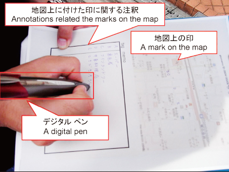
An example of a digital pen in use while in the field
Members of this project that consist of field-based area study researchers and information scientists will carry out field surveys in Thailand and Indonesia to integrate their ideas, skills and knowledge, and to create a new methodology and software/hardware for field-based area studies. Topics will deal with what members are interested in, such as land use, health and livelihood. Each of them will take about a week. Equipments and documents from the CSEAS Liaison Offices in these countries will be used for survey activities. After the field surveys, workshops for concluding results obtained through the surveys will be held at the Liaison Offices.
Dr. Tomita Shinsuke (University of Tokyo) who is a member of this project will stay at the Bangkok Liaison Office in the first half of FY2011 to collect data and prepare for the survey.
Description:
This project aims to present:
(1) Ways of more efficiently using conventional tools such as GPS and GIS in area studies.
(2) Concepts of hard/software that are suitable for area studies.
(3) Concepts of field data collection systems that have a fieldworker-friendly interface.
(4) Concepts of three-dimensional (time-space) database systems for area studies.
(5) Methodologies for sharing/analysis of geographical information with the database mentioned in (4).
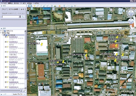
An example of digitalized fieldwork data mapped onto Google Earth
Geographical information technologies that are now rapidly developing have quite a high potential to be applied to area studies where geographical data collection through field surveys and analysis of spatial data is commonly conducted. However, there are many technical problems that prevent the use of such technologies
from being widely disseminating among area study researchers. For example, it is often too difficult for researchers to handle the latest geographical information devices in the field because of their weight, fragility, complicated interfaces and so on. This project will contribute to both the development of area studies and information science through in-situ discussions among area study researchers and information scientists.