- Project Leader : Shibayama Mamoru (Kyoto University, Center for Integrated Area Studies)
- Collaborators : Surat Lertlum (Chulachom Khrao Royal Military Academy, Computer Program)
- : Elizabeth Howard Moore (University of London, School of Oriental and African Studies)
- : Kobayashi Satoru (Kyoto University, Center for Southeast Asian Studies)
- : Matsuura Fumiaki (Sophia University, Institute of Asian Cultures)
Outline of Research
This project proposes two related case studies to delineate similarities between local and regional Buddhist cultures to enable the identification of local and transnational commonalities in past and living heritage communities.
The first study uses a comparison of artifacts to propose road, river, trade and cultural routes between eleven Iron Age and walled Buddhist sites in Upper Myanmar of the first millennium CE. The second study uses artifacts and local and foreign historical material from Dawei, Tanintharyi Division, Lower Myanmar, to define common historical links with Thailand and Cambodia. These include not only political and economic factors related to Dawei’s strategic maritime and inland connections, but common beliefs and ritual practices within the shared Buddhist heritage of these countries.
Description
The project aims to move beyond the ethno-linguistic and national paradigms embedded in the literature on Myanmar and neighboring regions. Post-colonial discourse risks replacing the local-foreign dichotomy with another model that essentializes the nuances which give local cultures their distinct identity. This project is instead geo-spatially grounded through the cities and places of the related case studies. Employing GIS to draw together historical records, remote sensing and cartographic resources, the local significance of artifacts are informed by road and river networks and the cultural corridor of past and living communities. This project underlines the inseparability of the environment and local prerogatives determining the syncretic character of Buddhist cultures across mainland Southeast Asia.
In this context, a geo-informatics structure is compatible with local chronicles, historical records and archaeological artifacts in mapping a cultural landscape of cities, rivers and peoples, their local beliefs as well as use, production and trading of resources. The project seeks not just quantitative data, but also an interpretation of the the past through anthropological documentation of natural resource use, the ritual beliefs and practices of living communities, an understanding of the past as well as the present routes linking physical and intangible networks.
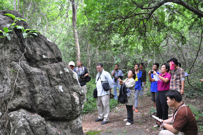
 Survey of stone statue discovered in nearby Thai-Cambodia border (20 July 2013) |
 Lecture on “East-West Corridor” in Department of Archaeology, Yangon University, Myanmar (26 July 2013) |
