The CSEAS Map Room
Description
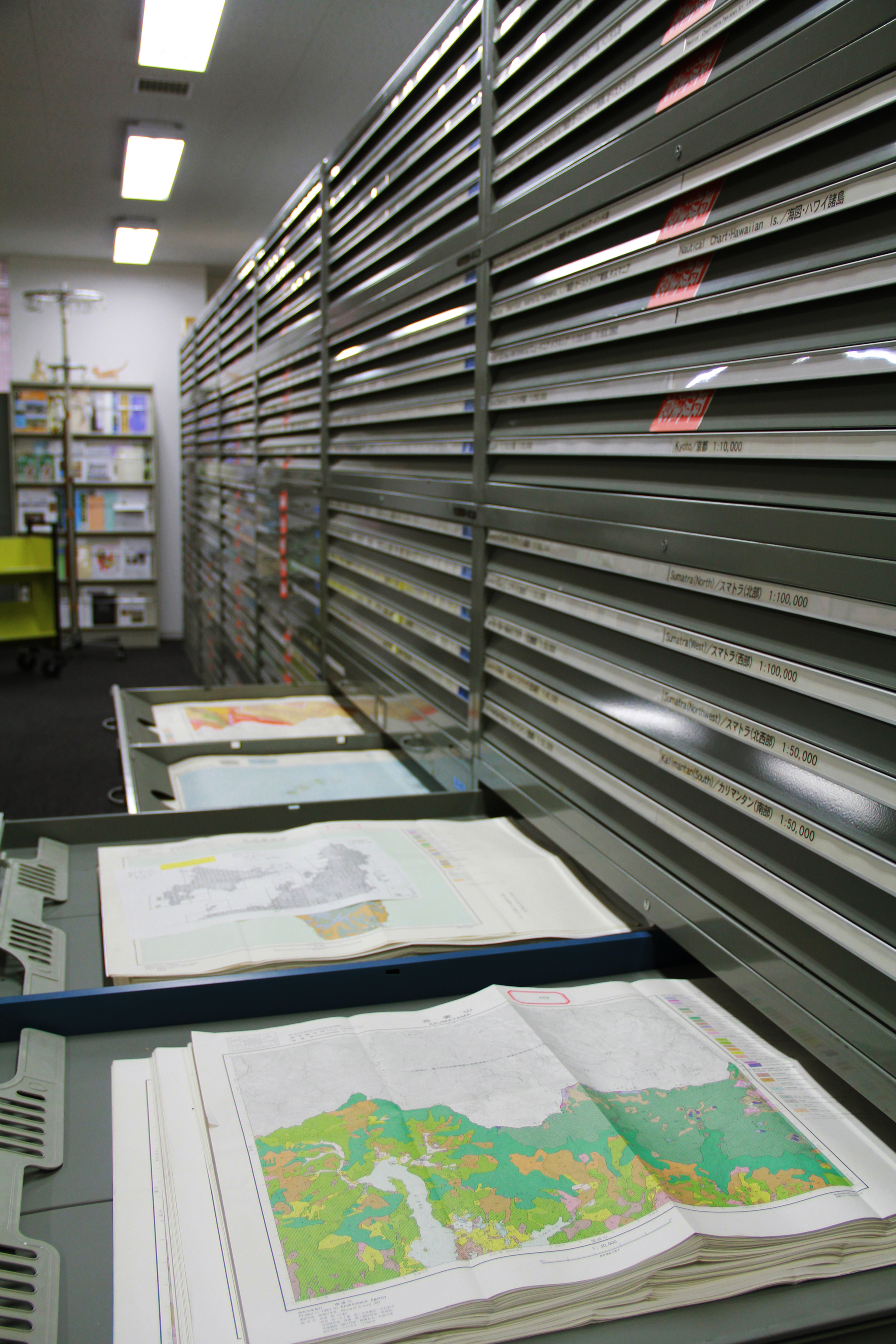
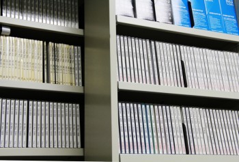
Map Room
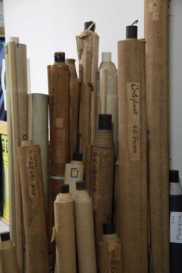
CSEAS holds about 43,000 sheets of maps of Southeast Asia and the surrounding areas of India, Bangladesh, Sri Lanka, Nepal, Pakistan, China, Korea Peninsula, Australia, Pacific Islands and Japan. The publication dates of these maps vary from the pre-World WarⅡperiod to more recent years, when the aerial survey for making maps became available.
The CSEAS staffs have been collecting satellite images since 1978, and today the Center Map Room holds about 3,500 scenes. In anticipation of the establishment of a new geographical information system, these maps – as well as other data – are now being digitalized.
Aerial photos of Southeast Asia and its environs, Human Ecology Files and the CSEAS DVD collections are also available in the CSEAS Map Room. For the details of each collection, see “The CSEAS Map Room Collections” in the next section.
The CSEAS Map Room Collections
Maps
Number of maps: about 43,000
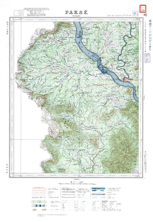
GaihouzuMaps called “Gaihouzu” in Japanese are historically valuable Japanese Army topographical maps and nautical charts covering South and East Asia as well as Southeast Asia. They prepared before and during World War II. About 19,000 Gaihouzu in the CSEAS Map Room comprise one of the foremost collections in Japan. The maps are classified by areas. On “Catalogue of Map Collections,” they are referred to by the words “Japanese Army Map Service” or “Japanese Navy.”
|
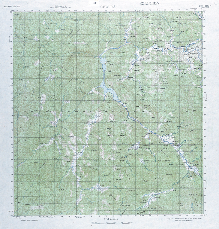
Other MapsBesides Gaihouzu, there are also 24,000 topographic, geological maps, land-use, vegetation, administrative, and road maps in the CSEAS Map Room. The topographic maps cover areas like Thailand, Laos, Vietnam, and Myanmar and parts of Gaihouzu are digitalized and available to the public on a limited basis. |
Wall MapsThere are about fifty (50) topographical, mineral product, geological, and vegetation maps on Japan, the former Manchuria, Taiwan, and the Korea Peninsula.
|
Maps of British Parliament PapersFor more information about these maps, please see the “Kyocera Collection of the British Parliamentary Papers” on the Center for Integrated Area Studies website. 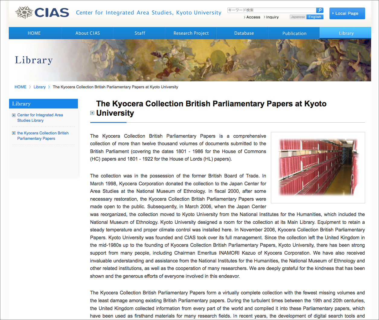 The Kyocera Collection British Parliamentary Papers at Kyoto University, Center for Integrated Area Studies, Kyoto University |
Satellite Images
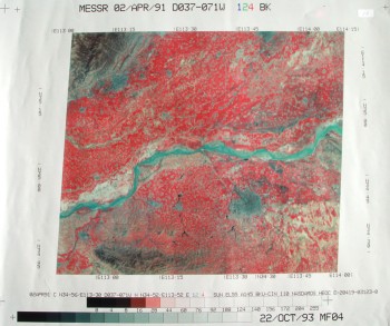
The CSEAS Map Room holds about 3,500 scenes of MOS-1 MESSR, JERS-1 SAR and Landsat-MSS/TM images (prints or digital data) covering Southeast Asia and surrounding areas that include India, Bangladesh, Southern China, and Japan.
Aerial Photographs
The Williams-Hunt Collection
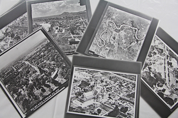
This is a very variable collection of about 5,800 aerial photographs acquired by Peter Williams-Hunt during and after the World War II, which were organized by Dr. Elizabeth Moore at the School of Oriental and African Studies, University of London. The collection mainly covers Cambodia (Angkor Wat), Thailand, Myanmar, Malaysia and Singapore. CSEAS has about 4,000 sheets of the collection, and their scanned images are also available. On-line data service is available at the website of “Geo-spatial Digital Archive Project”, developed by Dr. Surat LERTLUM from CRMA (Thailand), with the collaboration with CSEAS (Kyoto University), SOAS (University of London) and UNINET (Thailand). For details of the Williams-Hunt Collection, see this PDF file.
Besides the Williams-Hunt Collection mentioned above, the CSEAS Map Room also has about 3,500 aerial photos on Japan published by the Japan Geographical Survey Institute and about 2,200 photos in Laos and Indonesia.
Human Ecology Files (HEF)
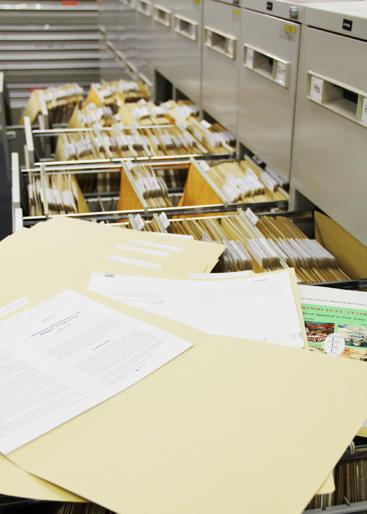
This is the set of materials on human ecology, which were collected and compiled into 5,600 files by Professor Terry Rambo at East-West Center, Hawaii. It includes various kinds of materials like abstracts of academic conferences, bulletins, reports articles of newspapers and journals throughout the world and were transferred to CSEAS in 2000. In later years, the files on Agro-forestry, and Watersheds were added to the original materials and the number increased to 9,200 files in total. They are collectively called the “Human Ecology Files” (HEF). For the details of HEF, see the Excel files below.
-Human Ecology Files 2009:
Excel 2003(4.81MB)
Excel 2007(1.77MB)
CSEAS DVD
About 4,400 topographical maps including the Gaihouzu, as well as 4,000 aerial photos from the Williams-Hunt Collection of the CSEAS Map Room have been digitalized in recent years. The CSEAS Map Room provides visitors for those digital data as well as about 170 satellite images that are stored in DVDs.
User’s Guide to CSEAS and CIAS Map Room
Hours
Open: Tuesday, Thursday, Friday 10:00 – 17:00 (Closed: 12:00 – 13:00)
Closed: Monday, Wednesday, Saturdays, Sundays, and Holidays
June 18 (Anniversary of Establishment of Kyoto University)
Year-end and New Year holidays
Summer Holidays: August 11 – 20
About the Collection
Users may access all collections in the CSEAS Map Room except for some restricted materials. All materials at the CSEAS Map Room are for internal use only. However, users can borrow materials temporarily and make photocopies as long as this does not infringe on their copyrights.
All materials are to be used only for non-profit purposes such as research or education.
A part of digital data (CSEAS DVD) may be duplicated in the CSEAS Map Room as long as this does not infringe on their copyrights. Users must bring brand-new CD-Rs or DVD-Rs for duplication.
Photocopying Materials
Hours: 10:30 – 16:30, weekdays except Wednesdays
Users are requested to contact the staff in advance if they want materials to be photocopied.
Contact:CIAS & CSEAS MAPS
address: 46 Shimoadachi-cho Yoshida Sakyo-ku
Kyoto, JAPAN 606-8501
Tel/FAX: +81-75-753-9650
E-mail: map@cseas.kyoto-u.ac.jp
- Users are requested to fill out the photocopy form with information that include their names, institutes, contact addresses, purpose(s) of usage, etc.
- Users will be asked for an official student or employee ID or driver’s license to photocopy it. Their personal records will never be used for any other purpose.
- Users are requested to return the materials to the CSEAS Map Room as soon as they are finished with the photocopying.
List of Materials at the CSEAS Map Room
| Materials | Availability | |||
| Maps | Other Maps | ○* | ||
| Gaihouzu | ○ | |||
| Wall Maps | ○ | |||
| Maps of British Parliamentary Papers | △ | |||
| Aerial Photos | △ | |||
| Williams Hunt Collection | △ | |||
| Satelite Images | Photos | ○ | ||
| Films | ×(In Preparation) | |||
| Human Ecological Files(HEF) | ○ | |||
| CSEAS DVD | Maps | ○ | ||
| Williams-Hunt Collection | ○ | |||
| Corona Films | ○ | |||
| Satellite Images | ○ | |||
* Some files are not allowed to be taken out temporarily
○ = Available and allowed to be taken out temporarily △ = Internal use only × = Not available
- For more details of materials at the CSEAS Map Room, please see the sections above or check the website of the Center for Integrated Area Studies.
- For users who wish to take out large number of items, they must obtain prior permission from the relevant CSEAS committee. Users are then requested to contact the CSEAS Map Room in advance to apply for permission.