Project Leader:RAGHAVAN, VENKATESH (Graduate School for Creative Cities, Osaka City University)
Collaborators: KONO, Yasuyuki (Center for Southeast Asian Studies, Kyoto University)
SHIBAYAMA, Mamoru (Center for Integrated area Studies, Kyoto University)
YONEZAWA,Go (Graduate School for Creative Cities, Osaka City University)
SONG, Xianfeng (College of Resources and Environmental Sciences,
Graduate University of Chinese Academy of Sciences)
Term:2011-2012
Outline of Research:
Soil erosion caused by deforestation and farming activities can change soil significantly within a short-term period, particularly in the mountainous area of Southeast Asia which has a heavy monsoon climate. It will be greatly helpful for decision makers to understand soil changes and their dynamics both on space and time in case of land use planning and water resource management. This research is focused on developing a framework for managing and sharing geospatial, providing geoprocessing functionality to derive up-to-date information from remote sensing data for soil mapping and execute spatial modeling algorithms to detect changes in soil dynamics. From the end users point-of-view, this system is an online framework, in which users can drive the system and produce a high quality soil map for a specific site by following a systematic geospatial processing workflow and feeding the system with the datasets that are acquired at present or the parameters that they are familiar based on local knowledge.
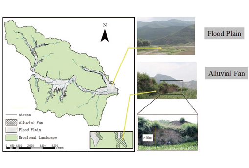
Example of landform classification
Description:
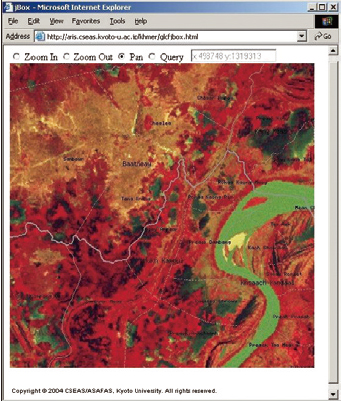
Land cover analysis using remote sensing data
The proposed system will consists of three parts. (1) The spatial databases that include three categories – basic data, remote sensing data and in-situ measurements. (2) Geoprocessing engine to provide online image processing capabilities for parameterization of environmental factors related to soil change using remote sensing datasets, for example, detecting spatial and temporal variations in vegetation indices that have been found to be linked to prevailing climates, ecosystems, terrains and physical soil properties, estimating ground components (end members) through sub-pixel analysis with a spectral mixture model, and mapping land cover through various image classifiers. (3) GIS will be used to integrate geospatial database, information derived from remote sensing and in-situ measurements for mapping soil dynamics using fuzzy logic based on the relationship between soil attributes, geomorphological and environmental conditions. The system will be tested with available geospatial data in China and Vietnam. The results will provide crucial inputs for hydrology and ecology models that could be used to predict the impact of land management practices on water, sediment and agricultural chemical yields in the above target areas.